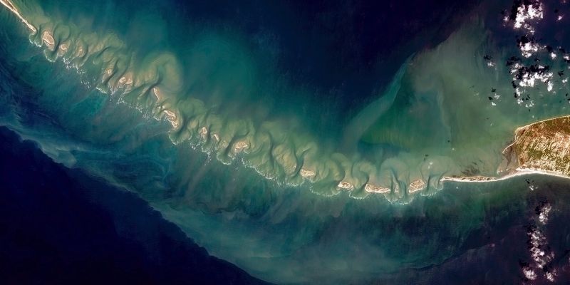
In a groundbreaking collaborative effort, ISRO and NASA have mapped the Ram Setu, also known as Adam’s Bridge, a legendary submerged structure stretching between Mannar Island, Sri Lanka, and Rameswaram Island, India. This initiative leverages advanced laser technology to provide unprecedented insights into this enigmatic underwater landscape.
Technical Triumph: Advanced Laser Mapping
Utilising NASA’s ICESat-2 satellite, the project achieved high-resolution imagery of Ram Setu, capturing details up to 40 meters beneath the sea level. The ICESat-2’s sophisticated green laser technology was crucial, penetrating the deep waters and mapping the seabed with extraordinary precision, gathering about 0.2 million photons to create a detailed bathymetric map at a 10-meter resolution.
Discovery Through Data: The Bridge Revealed
The comprehensive mapping process revealed that Ram Setu spans 29 meters in length and stands 8 meters above the seabed, stretching across a width of 1.5 kilometers. This detailed survey also unveiled 11 previously unknown submerged channels, adding depth to our understanding of the bridge’s complex underwater structure.
Historical and Cultural Resonance Ram
Setu holds profound historical and cultural significance in Indian mythology, believed to be constructed by Lord Ram, as depicted in the epic Ramayana. This connection provides a unique intersection of myth and science, as the bridge’s physical remnants are explored in tandem with its legendary narratives.
Geological Insights: A Bridge Through Time
Scientific analysis suggests that Ram Setu was once a land connection between India and Sri Lanka, only to be submerged following a severe storm in 1480. The project’s findings on the geological shifts and the historical timeline of the structure offer vital clues to the bridge’s past and its dramatic transformation over the centuries.
Future Implications: Charting New Waters
The rich data obtained from this mapping initiative paves the way for further research in marine geophysics and archaeology. By enhancing our understanding of submerged structures, the study opens new avenues for exploring ancient civilizations and assessing the impact of climatic events on geographical formations.
The collaboration between ISRO and NASA not only elucidates the submerged secrets of Ram Setu but also highlights the capabilities of modern technology in historical and geological investigations. This project not only enriches our historical knowledge but also underscores the importance of international scientific cooperation in uncovering the mysteries hidden beneath our oceans.