The NASA-ISRO Synthetic Aperture Radar (NISAR) is set to be launched in the first quarter of 2024 after a few tests, particularly those related to vibration, NASA officials have said.
“ISRO is projecting the first quarter of next year. So, I mean, that’s ready,” said NASA NISAR Project Manager Phil Barela, during a media interaction in Bengaluru on Wednesday.
He expects the launch of NISAR (pronounced ‘Naisar’) to be “not earlier than January” from the Satish Dhawan Space Centre at Sriharikota, aboard the ISRO geosynchronous satellite launch vehicle (GSLV) Mark-II.
The mission, which has a three-year duration, aims to survey all of Earth’s land and ice-covered surfaces every 12 days. This will start after a 90-day satellite commissioning period.
On the key tests that are pending, Barela said, “The vibration testing that’s underway, but there’s a whole slew of performance tests that we need to do.”
Battery and simulation tests have to be done to make sure the system works fine, he added.
“We’ll be doing performance testing on the radars and various spacecraft electronics. So, a lot of testing remains but the big environments test, the only one remaining now, is vibration,” he said.
NASA Jet Propulsion Laboratory Director, Dr Laurie Leshin, said the NISAR project is “better than anything that was flown in the past”.
“While there are datasets from past missions that can form sort of a baseline, this is a new level of capability that we will have with NISAR,” she had told reporters on Tuesday.
“If it’s working very well, we will almost certainly extend that mission to get that longer baseline. It is a very important thing to see the Earth change on multi-year timescales. This is what we are looking for,” Leshin had said.
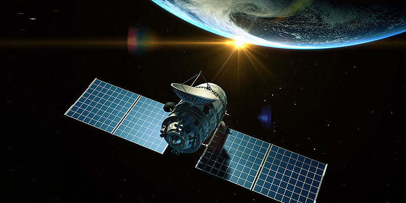
According to ISRO, NISAR is a Low Earth Orbit observatory being jointly developed by it and NASA.
NISAR will map the entire globe in 12 days and provide spatially and temporally consistent data for understanding changes in Earth’s ecosystems, ice mass, vegetation biomass, sea level rise, ground water and natural hazards, including earthquakes, tsunamis, volcanoes and landslides.
In a handout, NASA said the project aims to understand the dynamics of carbon storage and uptake in wooded, agricultural, wetland and permafrost ecosystems and the response of ice sheets to climate change, the interaction of sea ice and climate, and impacts on sea level rise worldwide.
NISAR will have a synthetic aperture radar instrument (SAR), an L-band SAR, an S-band SAR, and an antenna reflector. According to NASA, the onboard instruments can see even a minor change of one centimetre from space.
The SUV-size satellite has a mass of roughly 2,800 kg, which will be powered by two solar arrays providing about four kilowatts of power.
The six-foot-tall spacecraft bus will contain the command and communication systems for the instrument payload, which houses the two SAR instruments.
“The bus will also support the radar antenna reflector and its boom. There is enough fuel aboard to support at least five years of operations,” the handout said.
Edited by Swetha Kannan
![Read more about the article [Funding Roundup] Settlin, Rgyan, Kytchens and others secure early-stage deals](https://blog.digitalsevaa.com/wp-content/uploads/2022/06/settlin-1655708126631-300x150.png)
![Read more about the article [Funding alert] DMI Finance raises $47M equity investment from Sumitomo Mitsui Trust Bank, others](https://blog.digitalsevaa.com/wp-content/uploads/2021/11/Image3e9f-1606833617001-300x150.jpg)

![Read more about the article [Funding alert] Career discovery startup Mentoria raises Rs 1.5 Cr from Indian Angel Network, others](https://blog.digitalsevaa.com/wp-content/uploads/2021/05/Image82sv-1622016936685-300x150.jpg)


![Read more about the article [Funding alert] Wealth management platform INDmoney raises $75M in Series D](https://blog.digitalsevaa.com/wp-content/uploads/2021/07/V-05-1600852077699-300x150.png)